Our cartographers bring over 20 years of experience in nautical charting and topographic mapping — working across the world's most demanding marine and outdoor datasets.
01
Cartographic Data Research
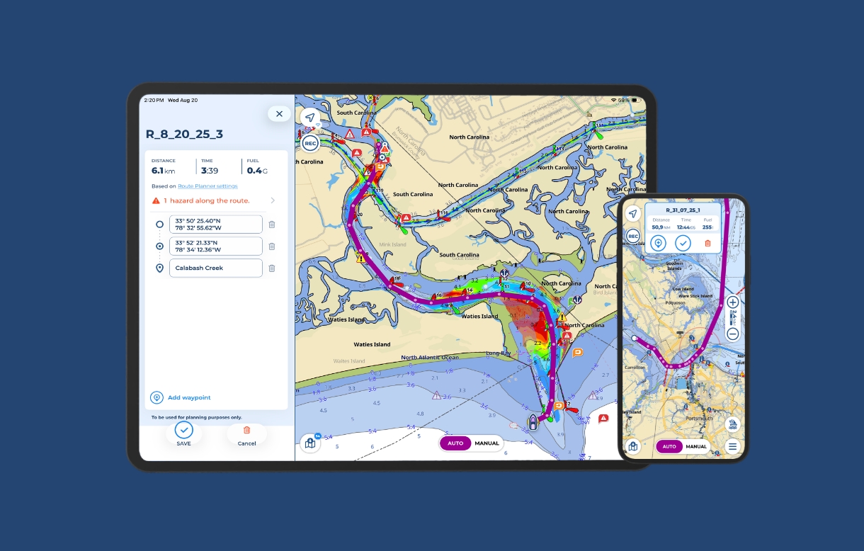
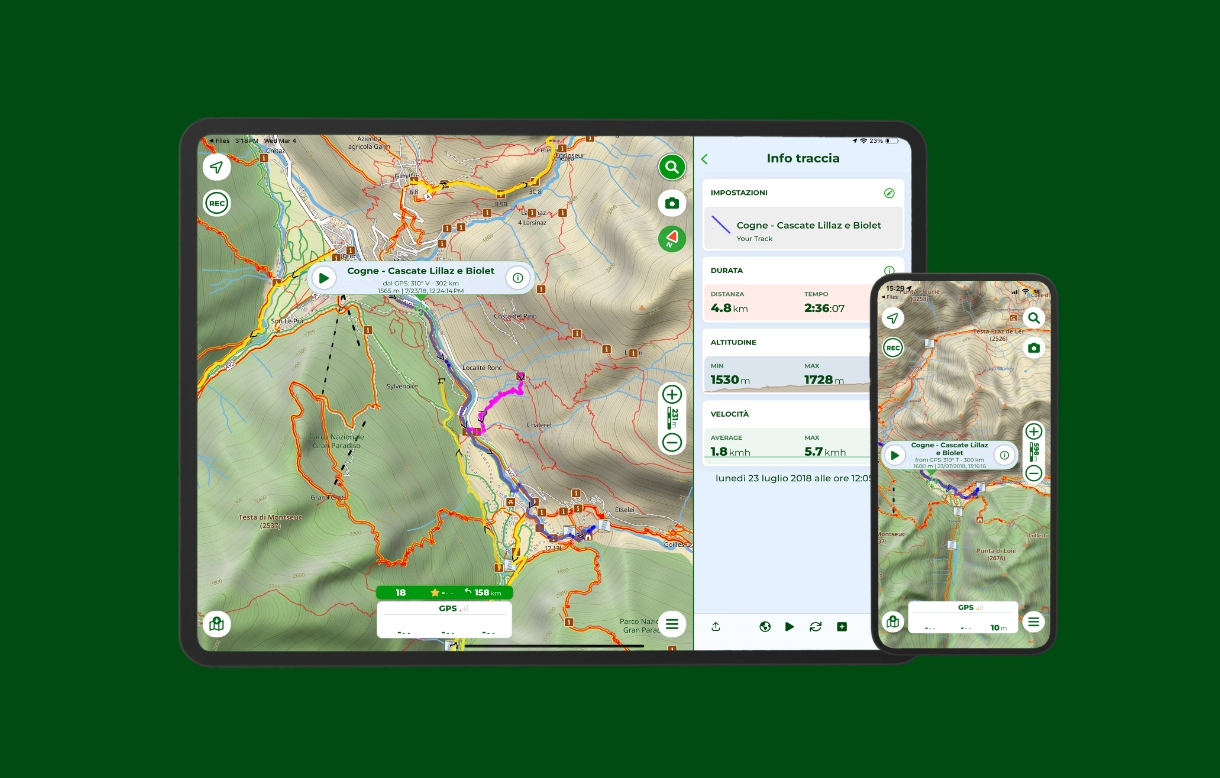
Deep expertise across global public and private datasets — hydrographic institutes (NOAA, British Admiralty, IIM, SHOM, AHS), national geographic agencies (USGS, IGM, IGN, Ordnance Survey, SwissTopo), satellite imagery (Aster, Ikonos, Digital Globe), and open sources including OpenStreetMap and TIGER. Every dataset we work with has been prototyped and field-tested.
02
Data Processing
Full GIS processing pipeline using commercial and open-source tools (ArcMap, QGIS, Global Mapper, SevenCs). Automated batch and scripting workflows, large-scale dataset management, road and outdoor routing networks, coordinate and datum conversion, and rigorous quality inspection and assurance.
03
Data Production
End-to-end production from raw source to finished product — digitisation, vectorisation, editing and attribution, final build, quality assurance, and automated batch testing. Formats supported include Shapefile, S-57, DEM, SRTM, KML/KMZ, GPX, SQLite, GeoTIFF, and all major marine chart formats (C-Map, Navionics, Garmin, Furuno, Raymarine, and more).